Structural and Mineralogical Characterization of the Clayey Deposits of Gbédji-Kotovi in Lama Depression, Bénin ()
1. Introduction
In the Benin Coastal Sedimentary Basin, there are thick layers of fatty plastic or very plastic clays of different colors, dominated by kaolinites, smectites, attapulgites, illites, chlorites, etc., associated with quartz, glauconite, anatase, microcline and many other trace elements: [1] [2] [3] [4]. In the Lama depression included in this Basin, marls and calcareous clays of Paleocene and Eocene formations are encountered, presenting physical and hydraulic properties which change according to the nature of their drainage: [5]. Moreover, the mode of stacking of these elementary clayey layers which constitutes the main criterion of the distinction of the mineral varieties is not yet known. It is identifiable nowadays, by study observation with the Electron Microscope by Scanning with X-rays or by diffractometry [6]. Depending on their structure and their mineralogy, these clay minerals, by storing water, can induce the loss of cohesion of the clay layers which contain them, and cause problems of shrinkage-swelling, rupture by shear and settlement [7]. These sensitivities, if well identified, can be treated using additive products or hydraulic binders. This study, therefore, aims to better appreciate the mineralogy and structure of these clays in order to identify their areas of industrial valuation.
2. Materials and Methods
2.1. Materials
2.1.1. Geology and Hydrogeology
Lama depression, is located in the middle part of the coastal sedimentary basin of Benin, and is characterized by an alternation of permeable and impermeable soils. The basin and seasonal rivers (Ouémé and Couffo rivers), from the main hydrographic network are dominated by relatively homogeneous formations with a significant vegetation cover [8]. The Lama depression is located in the middle part of the coastal sedimentary basin of Benin, and is characterized by alternating permeable and impermeable soils. The basin and the seasonal rivers (Ouémé and Couffo), originating from the main hydrographic network, are dominated by relatively homogeneous formations with significant plant cover [8]. Figure 1 shows the clay site studied who is located 15.6 km northwest of the Avakpa District, west of the Municipality of Allada.
![]()
Figure 1. Location of sample collection site.
2.1.2. Soils, Climate and Hydrology
The soils are essentially vertisols, hydromorphic, characterized by a high proportion of clay along the watercourses. The tributaries are of low importance with high slopes (from 5 to 13 m/km). On the barre lands and the Cretaceous and Eocene formations, the hydrographic network is not very marked, and the region is slightly hilly.
The clay site of Gbédji-Kotovi is located in the depression of Lama, between 2˚00' and 2˚10' East longitude, straddling 6˚40' North latitude, 15.6 km northwest of Avakpa District in the Commune of Allada (southern Benin) and dominated in the west by the valley of the Couffo river and in the east by Ouémé river. That site has mainly clayey and hydromorphic soils. The subequatorial climate generates long rainy seasons (mid-March, early November) and causes an average annual rainfall of 1100 mm. The rainy regime is bimodal, and divided into four parts which are the dry season (November to February), the long rainy season (March to June), the intercycle (July to August) and the short rainy season (September to October). The temperatures are between 27.3˚C in average with a maximum of 40˚C which ensures high relative humidity. Insolation varies from 200 to 210 hours/month in the dry season to 105 hours/month in the rainy season, which favors the fluctuation of potential evapotranspiration. The winds are moderate and blow from south to west. The main classes of land cover are settlements, crops and fallow land and oil palm plantations, in addition to vast swamps (Plate 1).
2.2. Methods
2.2.1. Site Mesh and Soil Sampling
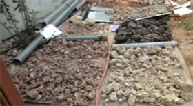
Six (06) boreholes were drilled in trenches which made it possible to intercept the roof of the clay and to carry out the necessary boreholes in order to take the sample according to the facies encountered. Various prospecting and laboratory equipment was used, namely geological and topographic maps, GPS, compasses, geologist’s hammer, machetes, shovels, hoes, pickaxes, basins, set of bags, tape, notebooks, camera, corers, thermometer, piezometer etc. Six 06 boreholes of at least 4 m depth, carried out manually according to regular grids of 200 m2 criss-crossing an area of 3 Km2 along the local watercourse adjoining the basin of the Couffo river. The mesh aims to make a representative sampling that takes into account the environment of the site and that projects the boreholes on the established geological cutting line. The samples studied are characteristic of two types of deposits on the same site, namely compact clays and heterogeneous clays (Plate 2). The first type of deposit is an entirely clayey profile down to a
 (a)
(a)  (b)
(b)  (c)
(c)
Plate 1. Main land uses in the locality of Gbédji-Kotovi. (a) Maize field on clay soil; (b) Vegetable garden in clayey shallow; (c) Old destroyed house built on clayey soil.
 (a)
(a)  (b)
(b) 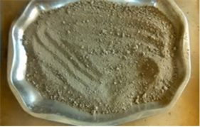 (c)
(c)  (d)
(d)
Plate 2. Sampling process. (a) Sun drying; (b) Negative well: no visible clay; (c) Sediment after crushing at Los Angeles; (d) Pit showing clay deposits.
depth of 3.5 m, i.e.: 1) Black plastic clays (0 to 1 m); 2) plastic gray clays (1 to 2 m); and 3) thick plastic black clays (2 to 3.5 m). The second type of deposit presents several horizons: a very organic humus (0 to 0.5 m), a slightly silty medium sand (0.5 to 1 m), a loosely compacted and fissured silty clay with ferruginous concretions (1 to 2.7 m) and a compact silty clay (2.7 to 4.2 m). Through microscopic analysis, the following operations were carried out on the samples such as 1) drying by sunlight and then grinding the sample aggregates in Los Angeles; 2) oven drying for 24 hours at a temperature of 105˚C; 3) sift the clay powder (5 mm sieve); 4) Storage in plastic packaging and transport by air for analysis at the Tangier Laboratory in Morocco.
2.2.2. Prospecting and Collection of Hydraulic Data
On the regional level, data had been collected from deep boreholes drilled over the past ten (10) years by projects as part of water supply in the study area. Depending on the available database, a minimum of 05 more or less aligned wells have been identified to achieve a characteristic synthetic hydrogeological section North-West-South-East. The wells very closed to the cutting line were correlated for having maximum of information. Water levels in the wells were measured using a piezometer.
2.2.3. Dynamic Penetration Test (French Standard P 94 - 115)
This test was carried out at the National Center for Testing and Research in Public Networks (CNERTP). The test mainly makes it possible to distinguish the different layers crossed, but without characterizing them. The lightweight motorized dynamic penetrometer is more suitable for this study, as it is easily transportable, even in areas that are difficult to access. It consists of a train of metal rods terminated by point of given section. The assembly is driven in by ramming by means of a ram of known mass, falling in free fall from a fixed height. The number of strokes required to drive the drill string to a predefined depth is measured. The geometric characteristics of the probing point are apex angle (90˚); section at the base of the cone (15 cm2); outside diameter of the beater rods (32 mm); mass of the sheep (30 kg); fall height of the sheep (50 cm); driving speed (between 15 and 30 strokes per minute). During the test, at each step of 10 cm, the number of strokes N necessary to drive the drill string over the length of the step is recorded. The measurement of the number of strokes (N) necessary to drive the drill string 10 cm (Table 1) makes it possible to determine the dynamic peak resistance Rd (in kg/cm2) defined as follows:
(1)
with M = mass of the threshing hammer (kg); H = Sheep fall height = 50 (cm); A = Section of the tip = 15 (cm2); e = penetration per stroke = 10/N (cm); P = total mass of drill string and anvil [kg].
The value of the bearing capacity (allowable stress qadm is deduced from the value of Rd by the formula:
(2)
2.2.4. Energy Dispersive X-Ray Microanalysis (EDX)
The systematic study of clay samples with the Scanning Electron Microscope
![]()
Table 1. Well 1 and 2 dynamic penetration test parameter measurements.
(SEM) aims to identify the organization of clay particles and to identify certain textures and their implications in the behavior of the soil studied. Analysis by EDX provides a diffractogram which constitutes a set of lines which are reflections of X-rays on the planes of organization of the elements Al, Si, O, OH in the crystal lattice. Certain lines mark the reflection of X-rays at the surface of each sheet and measure the reticular distance “d” between two surfaces. That test was carried out in Hydrogeology Laboratory of the Faculty of Sciences and Techniques of Tangier in Morocco. The principle of SEM is based on the emission of electrons produced by a cathode and the detection of signals coming from the interaction of electrons with the sample. Those electrons penetrate deeply into the material and affect a volume called the “interaction pear” which depends on the average atomic number of the sample and the energy of the incident electrons (Figure 2). The D8 Advance Eco Diffractometer was mainly used because of its economic and ecological advantages and particularly for its high resolution. It is equipped with a Universal Goniometer that can be used in vertical and horizontal position, with a variable measuring circle and a central opening for mounting various accessories. This instrument features:
• A high-efficiency 1 kW X-ray source: very high lifetime and brilliance;
• Reduced energy consumption, without the need for cooling water;
• A Copper anode of radiation E = 8.048 Kv, with a crystal graphite (2d = 0.6714 nm, 002 Mosaic Spread reflection Approx 0.4˚). The wavelength used Cu Kmean = 1.54184, K_1 = 1.5406, K_2 = 1.54439;
• A one-dimensional SSD160 LYNXEYE detector for ultra-fast X-Ray measurements, composed of silicon strip technology. The active area of the detector is 14.4 mm by 16 mm;
• High quality diffraction data acquisition, more than 125 times faster than a conventional point detector;
• High angular resolution with a minimum step of 0.0001˚; stepper motor positioning, and optical encoders.
![]()
![]()
Figure 2. Operating principle of the SEM (left) and D8 Advance Eco Diffractometer (right).
The analysis was carried out on samples GK1_0.5, GK2_1.3 and GK2_2.6 taken from well 1 at depth 0.5 m and from well 2 at depths 1.3 m and 2.6 m. A separation of the various fractions by sieving was made in order to characterize them more separately the granulometric phases. Images are taken at magnifications ranging from 43 to 2000 with grain size (coarse, medium and fine) and pore size measurements.
3. Results and Discussion
3.1. Stratigraphy
The stratigraphic logs of some deep wells show the levels of fine sands, medium sands and coarse sands for varying thicknesses, alternating with clayey levels (Figure 3). The clay levels are very heterogeneous. Those are sandy clays; clayey
![]()
Figure 3. Synthetic hydrogeological section (Gbédji-Kotovi, Allada), adapted from Iheta et al., 1982.
sands; grey, yellow and whitish clays, etc. The deposits are tabular, discontinuous and tilted at about 10˚C from the horizontal, towards the West. Areas of structural weakness are visibly streams, depressions and mounds, including horsts and grabens. In addition to sometimes outcropping clay deposits, a sequence of unconsolidated deposits of varying thicknesses including laterites, sands and fluvial gravels has been identified. The clay deposits are either outcropping or are embedded in a matrix of sand and silt with a very wide grain size, which does not allow us to differentiate the various litho-stratigraphic units with precision at this stage of the present study. Under the western part, the sandstone level passes above the sandy aquifer. This layer of sandstone could have certain porosity and probably play an important role with respect to the chemical quality or the contamination of the water of the underlying aquifer. Indeed, it forms, with compact clays, walls or cover rocks for sandy aquifers or underlying sandy-clayey. On the other hand, the clayey-sandy and sandy-clayey levels should ensure drainage of surface water towards the sandy aquifer. Despite their poorly known transmissivity, we know that they constitute water-rich levels and that they generally present a permeability of interstices. Even if the indurations or desiccation should impose greater vertical permeability than the horizontal permeability, the tabular form of the deposits shows that there would be more conductive, heterogeneous and anisotropic sub-horizontal zones.
The alternation of clay and sandy levels does not rule out the existence of several perched aquifers with interstice permeability, but many elements are missing for a better interpretation of the drainage in these different sedimentary deposits. Soundings, geophysical reconnaissance and detailed stratigraphy could provide these elements, and it would be particularly instructive to operate a new synthesis taking into account the reality of aquifers and their real possibility of exploitation. The synthetic hydrogeological section (Figure 3) shows that the clayey deposit sinks towards the east where rainwater and runoff must cross it before reaching the sandy and sandy-clayey aquifers at a certain depth. This Eocene formation underwent successive periods of erosion, accompanied by the sequences of deposits that covered it. Following this section, we successively note: 1) alternating clay-sandy and sandy-clayey layers of alteration, topped by recent alluvial and lateritic deposits to the east of the locality of Gbédji-Kotovi; 2) a level of sandstone above the clays; 3) aquifer levels of fine, medium and coarse sand resting on a thick clayey layer up to the maximum level reached by exploited boreholes, about a hundred meters from the natural ground level.
3.2. Consistency of Soil Layers
The dynamic penetration test confirms the results of the core drillings. Indeed, the site has two main types of deposits with different consistencies. A first zone indicating high resistance and high stresses that can reach 195 bars and 9 bars respectively. These values are due to high clay content, which does not favor the rise of water from the aquifer. The second zone presents a sinusoidal evolution of the admissible stresses and of the breaking strength limited respectively to 100 bars and 8 bars with minimums which can go down to 30 bars and 1 bar respectively (Figure 4). It is made up of alternating clay-sandy and sandy layers. The sandy layer (below 5 m) could not be reached by our surveys. This layer could constitute an aquifer for the local area. However, due to the absorption of all the energy of battance by the interstitial water, this type of test could give strongly overestimated values of the peak resistance. In this sense, it would be more effective to use it in unsaturated permeable or low permeable media.
3.3. Microscopy
Observation under the scanning electron microscope made it possible to observe the texture of the clay samples and to characterize the mineralogical assemblages. Energy dispersion X-ray (EDX) spectra show overlapping peaks. Iensity of peaks shows the presence of major elements such as silica and oxygen. We note minor concentrations of aluminium, potassium, iron, magnesium, sodium and calcium, as well as the increase in silica peaks with depth (Table 2).
The value of Parameter B = Fe + Mg + Ti is low compared to that of the parameter A = Al − (Na + K + 2Ca) (Figure 5): the samples analyzed are poor in calcium and magnesium and rich in silica, iron and aluminium. According to the classifications based respectively on the alumina saturation (Al2O3) and the silica content (SiO2), we deduce that these clays are hyper-aluminous and intermediate (acid-base). Consequently, the clays studied would come from the alteration of acid rocks of the granitoid type. These minerals of detrital origin from the Paleozoic and Precambrian formations which form the bedrock have therefore undergone alteration and then been deposited in a current of varying intensities [9] [10].
Microscopic observations show a range of morphologies which can be classified according to the QW variation in their shape and the size of the grains which constitute them. The structure reveals a maximum coarse grain size of about 800 μm. These grains present between them pores ranging up to 130 μm at
![]()
Figure 4. Variation of allowable stress and ultimate strength with depth.
![]()
Figure 5. Microphotographs (with SEM) coupled with X-ray energy dispersive reflection peaks of clay sediments from Well 1 and Well 2.
low magnification and up to 1.14 μm for high magnifications, thus suggesting inter-aggregate pores greater than 0.05 μm. On the other hand, the inter-particle porosity is not very developed. At high magnification, we note a smectic texture in laminar form, showing particles in an elongated turbo-static position, with more or less rounded edges (Figure 6).
The predominance of inter-aggregate porosity, the smectic structure and the presence of quartz and carbonates induce an increase in heterogeneities in the microscopic sense which in turn develop mechanical sensitivity and high hydraulic conductivity or retention capacity. The studied clays have an open structure,
![]()
Table 2. Chemical composition of samples.
![]()
Figure 6. SEM photomicrographs of clay sediments from Gbédji-Kotovi.
since they contain large voids. The size distribution seems to be the same for all the samples. The microstructure indicates large grains embedded in a sintered clay matrix. However, local voids are observed (interfaces between the large grains and the matrix phase). These heterogeneities are believed to have an important role in pore interconnection. The results thus indicate the important role of the morphology of the pores as well as their interconnectivity, which favors the existence of less tortuous and more permeable paths, thus facilitating the flow of water in the material. However, this heterogeneous character could constitute a good indicator of compaction [11]. It is also possible to envisage their use in the field of drilling muds, because of their similarity to montmorillonites. In this case, further activation tests should be performed to improve the performance of the material. The chemical and microscopic results agree with those of former studies who identify the Gbédji-Kotovi clays as alumino-ferriferous smectites, with low quartz content, accompanied by a partly poorly crystallized kaolinite. A clay fraction of 48.9% reveal a beidellite of low specific surface (100.59 m2/g), composed of 82.46% smectite against 15.77% kaolinite, to which are added some traces of illite/chlorite. The present study of clay facies with more than 50% fines (<2 μm) complements that of previous authors and confirms their interest as drilling mud in the industrial or commercial field.
4. Conclusion
Knowledge of the micro-textures of clay materials studied by observation under a scanning electron microscope makes it possible to highlight mechanisms and drainage behaviors that mechanical parameters alone cannot explain. The behavior of a floor can also be explained by the creation of a final micro-texture, taut in one direction and looser in another. It is therefore the network of discontinuities that is essentially responsible for the hydromechanical behavior of the soil. The rearrangement of clay aggregates and their spatial distribution can be decisive due to the rearrangement of aggregates and the closing of discontinuities. In the case of heterogeneous clays, the physical, chemical, mineralogical and geotechnical parameters have to be recorded simultaneously. The micro-texture therefore conditions and orients the phenomenon of swelling, compaction or rupture of the soil. The observation of micro-textures under a scanning electron microscope, therefore, makes it possible to explain these mechanisms. The essential role played by the micro-textures during the swelling is highlighted and it is possible to obtain a better interpretation. The results of this study constitute a solid basis for initiating other research to evaluate the behavior of the additions of binders to the clays of the Lama depression in order to test in a concrete way their capacity to be exploited industrially as sludge boreholes or as fill material.