Sedimentological Study of Alluvial Deposits on the Congolese Coast: Highlighting the Erosive Character of the Holocene Wet Climatic Phases ()
1. Introduction
The Congo coastal plain is 3 to 6 km wide north of Pointe-Noire and has a surface cover of yellow ochre sands resulting from repeated reworking of the Plio-Pleistocene foothills sands of the Cirque Series and Cover Formation and their transport into Loango Bay by coastal rivers. Recent work on the neighboring Gabon Basin [1] emphasizes the general importance of eolian accumulation on the scale of the last three millennia on different substrata of a yellow formation that he named the Formation de Couverture. In our study area, this formation overlies the Cirque Series [2].
The Congolese coastline has been the subject of numerous studies that have traced the broad lines of paleoclimatic and paleoenvironmental evolution over the last 50 millennia. These studies concern both the marine and continental domains [3] - [10]. This evolution is characterized by alternating wet phases that coincide with high sea levels and the development of mangroves and dense rainforests on the mainland, and dry phases marked by the retreat of shorelines and the regression of forest formations on the mainland.
The originality of the Loango Bay area lies in the wide extension of contemporary peat deposits from the Holocene high seas that lie in a gully unconformity on a podzol. These deposits are now exposed as a result of marine erosion and thus constitute, before their disappearance, valuable study materials. They have been dated between 7205 and 4000 years B.P. in the whole bay of Loango and between 380 and 350 years B.P. at Kivesso. These deposits, which contain no evidence of communication with salty or even brackish water, would therefore have accumulated in elongated depressions sheltered by barrier beaches that have now disappeared in relation to the rise in oceanic waters, which have created a hydrodynamic barrier to the downstream flow of fresh water. The shreds of large laterite blocks, soft gray clay pebbles packed in the sandy-gravelly matrix at the Kivesso site, are evidence of a large alluvial phase that clogged the 7200-year-old B.P. swamps but whose deposits were gullied by exceptional large floods of the coastal streams. This large flood phase was also recorded in the Kouilou estuary where there is an absence of contemporary alluvial and estuarine sedimentary evidence in the 5000 - 1000 years B.P. interval [11].
It would be during this climatic interval with large, globally contrasted, more brutal and therefore more erosive floods that the coastal rivers would have ravaged the channels, followed by a progradation of the deposits towards the ocean, and this during the period of stabilization of the ocean level [9]. A second interval is superimposed on this interval, during which peat swamp basins of ages ca 380 and 350 years B.P. develop in the kivesso sector [11]. These swamps are covered by rather coarse fluvial sequences 4 to 5 m thick that characterize this sandy-gravelly formation of the yellow ochre formation and which ends with the establishment of a paleosol 10 to 20 cm thick very regular over the entire bay and over the entire outcrop and dated ca 220 years [11]. This study aims, through detailed sedimentological analysis, to characterize these erosive phases.
Presentation of the Study Area
The study area is located northwest of Pointe-Noire on the coastal plain that narrows in the Loango sector, at the foot of the Hinda plateau. The average altitude is 20 m. It lies between longitudes 11˚48'17.09'' and 11˚49'35'' East and latitudes 4˚36'23.02'' South and 4˚39'30.02'' South (Table 1, Figure 1).
The climate in the study area is of the Bas-Congolese type, characterized by an alternating hot rainy season and a cool dry season (Atlas du Congo, 2001). The hot rainy season extends over 8 months, from October to May. It is characterized by high and contrasting rainfall. The average annual rainfall in the region is 1211 mm (A.N.A.C, 1978 to 2008). Rainfall averages 160 days per year, with a very irregular temporal distribution over seven months. The months of June and September provide a transition into and out of the dry season.
The vegetation consists of a mosaic of forests-savannahs with a clear predominance of the savannah. The savannah is either herbaceous, dominated by Loudétia and hypparhenia, or shrubby, dominated by Annona senegalensis, a small plant (0.5 to 1.5 m high) with poor ground cover [12]. These savannahs have been replaced for more than 80% by an artificial forest composed mostly of eucalyptus and secondarily of pine and accacia. This massif occupies mainly the plateaus, sometimes the summits and the sides of the hills.
Geologically, the coastal plain is constituted by formations of Plio-Pleistocene age of the cirque series, formed essentially of sands with intercalations of clayey levels [13]. These sands include multiple hardened horizons evolving into paleosols. The cirque series of fluvio-lacustrine [14] or fluvio-deltaic [15] origin is overlain by fine, clayey and silty yellow sand of the Cover Formation of eolian origin [2]. The Cretaceous formations outcrop along the Mayombe rim where they form the contact formations and at the points along the coast.
2. Material and Methods
In order to answer the problem of this study, the material used is composed of samples of peat, yellow gravelly sand, white podzol sand and clay taken from several outcrops (Photo 1). The material collected is subjected to a macroscopic and lithological description, a sedimentological study, mineralogical (morphoscopy and exoscopy), organic geochemistry, the Rock-Eval study and peat dating. The peat samples are divided into two categories: highly carbonized peat (Photo 2 and Photo 3) and powdery peat (Photo 4 and Photo 5).
![]()
Table 1. Geographical coordinates of the sampling sites.

Photo 1. Placing the yellow formation outcrop in the southern Loango bay.
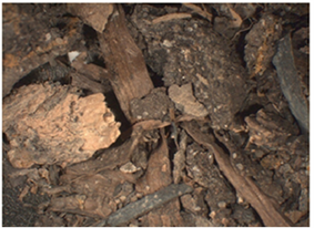
Photo 2. Sample of the washed organic material from Loango village north (LA2a).

Photo 3. Sample of unwashed organic matter from Loango village north.

Photo 4. Washed sample of powdery peat from Loango village nrth (LA2b).

Photo 5. Level of powdery peat in Loango village north (LA2b).
• Highly charred peat is associated with clay found at the base of several outcrops just above the white podzol sands. This peat contains clearly visible roots and bark, elongated parallel to the stratification planes of the clay forming centimeter-sized black beds. The presence of roots and stems confirms the autochthonous character of this organic material.
• The powdery peat is located on the northern edge of the village of Loango. This powdery peat contains a very large fraction of fine blackish gray sand. This peat level 50 cm thick rests directly on the white sand of the podzol. It includes small fragments of brown bark of various shapes (Photo 4 and Photo 5) and roots.
The peat of Kivesso little evolved and well stratified like that of the village Loango. The centimetric thick dark beds alternate with layers of brown clay of metric to decametric thickness.
The sedimentological study presents the granulometric and exoscopic analysis of quartz grains.
The granulometry made it possible to carry out a sieving of the coarse fraction in the laboratory of the Office of Building Control and Public Works (BCBTP) in Congo Brazzaville. This study made it possible to draw the grain size curves, then to calculate all the grain size indices in order to obtain indications on the energy and the type of transport having led to the placement of the sediments.
The exoscopic study was performed using a scanning electron microscope (SEM). The quartz grains were selected using a binocular loupe.
The analysis of organic geochemistry using the Rock-Eval Pyrolysis method consists of heating a sample (100 mg) previously dried and ground with an REB pyrolyzer (turbo model, Vinci Technologies®, France): first between 200˚C and 650˚C in nitrogen (pyrolysis), then between 400˚C and 850˚C in the presence of oxygen (oxidation) according to the same temperature gradient (25˚C/min). This analysis was carried out at the Organic Geochemistry Laboratory of the Geological and Mining Research Bureau (BRGM) Orléans France.
3. Results
3.1. Sedimentological Analysis
a) Particle Size Analysis
The index of the dominant sand populations was obtained from the particle size analysis by sieving the sandy fraction in accordance with the AFNOR standard.
- The particle size analysis of Holocene sediments in Loango Bay shows that they are essentially sandy-clayey and very poor in silt, alternating with beds of silty clays sometimes rich in organic matter. These sands have a predominant mode of 0.20 mm and an average varying between 0.150 and 0.300 mm. They are associated with a mode population of 0.125 mm sometimes 0.050 mm with an average varying between 0.100 mm and 0.126 mm. The correlation diagram between the mean and standard deviation (Figure 2) shows two types of deposits:
- a first dominant deposit that shows the existence of a correlation between the mean and the classification index. The diagram shows that as the average grain size decreases, the classification becomes worse, reflecting a progressive decrease in the velocity of the transporting stream as the value of the classification index increases. This poor classification is related to the influence of fine elements that become increasingly abundant and contaminate the average classified sediment as the current intensity decreases. These sands are fairly well classified and moderately classified (Figure 2).
The evolution of asymmetry as a function of the mean (Figure 3) also shows that the Loango Bay sands can be grouped into two groups: a group with granulometric symmetry, made up of both fine and medium grains in relation to the mean diameter, and a group of sands with positive asymmetry dominated by small grains in relation to the mean diameter.
These sands all fall within the R-Q segment of Passega (Figure 4), corresponding to uniform suspension transport.
Plotting the values of the median against those of the standard deviation in the [16] diagram (Figure 5), we notice that the cloud of points is located in the area of sands of fluviatile origin.
Robinson pipette size fractionation representing the vertical variation of these values along the profiles (Figure 6) shows that:
- The clays of Kivesso 2 have very low contents except at the level of the basins (depths 1.15 and 1.90) where they reach 30%. They do not exceed 5% along the profile. The silt content does not exceed 7% in the whole profile. On the other hand, fine and coarse sands constitute the dominant fraction with contents exceeding 60%.
![]()
Figure 2. Correlation diagram of the mean and standard deviation.
![]()
Figure 3. General diagram of the relationship between the asymmetry and the mean of the Loango Bay sands.
![]()
Figure 4. C-M diagram of Passega sands in Loango Bay.
![]()
Figure 5. Miola, R.J. and Weiser, D. (1968) diagram of the Loango Bay sands.
![]()
Figure 6. Vertical variation of the proportions of clays, silts, fine and coarse sands along the profiles of Kivesso 2, Kivesso 4 and Loango Nord 2.
- Kivesso 4 clays are high at depths of 1.8 m which corresponds to peat and at depths of 2.45 m and 3.1 m which are paleosols where they exceed 50%. At the same depths, silt content reaches 20%. In the other levels of the profile fine and coarse sands constitute the dominant fraction.
- The Loango North 2 clays reach 50% in depths of 4.2 m and 4.48 m which are grey levels that frame the sandbanks. The sandy faction exceeds 80% along the rest of the profile.
The methodology used is that of the AFNOR series. The refusals of each sieve were cumulated and allowed to draw the cumulative curves from which we determined the granulometric indices Q5, Q16, Q25, Q50, Q75 and Q95. These indices allowed us to calculate the particle size parameters such as the mean, standard deviation and skewness according to the formulas of [17].
b) Cumulative Curves of the Kivesso 2 Sands
The cumulative sieve size curves of the Kivesso 2 sands are presented in Figure 7.
Analysis of the cumulative sieve curves of the Kivesso 2 sands shows two main groups of sand:
- The first group is made up of sands with regular sigmoidal cumulative curves with a medium slope and spread out between the medium and fine sands.
![]()
Figure 7. Cumulative particle size curves of Kivesso 2.
- These are the sands of KVS2-1 to KVS2-3; KVS2-5 to KVS2-11; KVS2-13 to KVS2-15; KVS2-17 to KVS2-18a from KVS2-19 to KVS2-20 and finally from KVS2-22 to KVS2-23.
- The second group is composed of sands with cumulative sigmoidal curves with a moderately steep slope between fine and very fine sands. This is the case for the sands of the KVS2-4, KVS2-12, KVS2-16, KVS2-18b, KVS2-21 and finally KVS2-24 levels.
The particle size parameters of Kivesso 2 sands, obtained from the particle size indices determined from the cumulative curves are presented in Figure 8.
The cumulative grain size curves from Loango Nord 2 (Figure 9) can be grouped into two categories, each representing a particular sedimentary environment:
- the irregular sigmoidal cumulative curves with two levels and average slope characteristic of the badly classified sands constituted by several granulometric stocks LN2-2a, LN2-2c, LN2-4, LN2-8a, LN2-10), these curves represent the channel;
- regular sigmoidal cumulative curves with a steep slope characteristic of well-graded and homogeneous sands (LN2-3, LN2-6, LN2-9), these curves represent the basin;
![]()
Figure 8. Particle size parameters of KVS2.
- regular parabolic cumulative curves on the fine side (LN2-5, LN2-7), these curves represent the floodplain.
c) Petrography and Mineralogy of the Sandy Fraction of the Yellow Formation
Overall the detrital fraction of the yellow formation in Loango Bay has three distinct grain size fractions:
- Very coarse ochre yellow sands of mode 0.500 mm, associated with pebbles of white quartzites, red laterites, and soft pebbles of grey argillite. These last two are of decimetric to metric size. They are found in particular in the terraces in the Kivesso sector (Photo 6 and Photo 7).

Photo 6. Laterite pebbles in the gravelly sand level.

Photo 7. Red silty sandstone pebbles.
- The coarse to medium yellowish-white sands with black laminae of heavy minerals, with ripples and laterally transitioning to medium to fine brick-red sands of 0.500 mm mode. These sands fill the erosion gutters that are very common in the Kivesso sands.
- The laminae of fine white to yellow silty and clayey sands that overlie the peat levels are also found in gray to black clay beds when they are rich in organic matter.
The mineralogy of the sands is essentially quartz at 90%. They are matte and shiny quartz. The mineral debris is essentially made up of quartz of various shapes.
3.2. Morphoscopy and Exoscopy of Quartz
Morphoscopy and exoscopy have identified several categories of quartz grains. We describe here the most significant ones.
a) The Blunt Quartz Grain
The blunted quartz grain appears as a large dissolution dihedral (Photo 8). Under the scanning electron microscope (Photo 9), the dissolution figures have edges that correspond to dissolution dihedral facets. The geometry of dissolution as well as growth is controlled by the orthorhombic crystallography of quartz. The dissolution is posterior to the transport that blunted the grain. The dark geometric figures observed on the grain correspond to small dissolution cavities filled later.

Photo 8. Microphotograph of a blunt quartz grain with a large dissolution dihedral.
![]()
Photo 9. Scanning electron microscope microphotograph of quartz grain with dissolution figure.
b) The Angular Quartz Grain
The angular quartz grain studied shows clogged dissolution cavities (Photo 10). The clogging of the dissolution cavities is made of two generations of white kaolinite neoformed in situ: a first generation formed by large stacks of kaolinite in tablets of 5 to 10 microns height.
c) Round Matte Quartz Grain
The round matte quartz grain (Photo 11) shows under the scanning electron microscope (Photo 12) several fingernail-like percussion marks reflecting its eolian character.
d) Irregular Matte Quartz Grain
It shows under the scanning electron microscope a surface undergoing dissolution. The dissolution cells show the geometric facet of the orthorhombic system which is associated with kaolinitic clusters.
e) Rounded Quartz Grain, Ochre, with Dissolution Figures
The rounded, ochre quartz grain (Photo 13) shows under the scanning electron microscope dissolution figures covered with a kaolinitic coating associated with goethite needles.
![]()
Photo 10. Microphotograph of angular quartz showing clogged dissolution cavities.
![]()
Photo 11. Macroscopic microphotograph of round matte quartz grain.
![]()
Photo 12. Scanning electron microscope Microphotograph of the round matte quartz grainbearing the marks of percussion in fingernail strokes.
![]()
Photo 13. Macroscopic microphotograph of a rounded quartz grain showing dissolution figures.
The study of detrital debris from Level 2b of the fine to medium beige sands that overlie the brown cardboard clay that contains powdery peat from Loango village was carried out macroscopically and by scanning electron microscope. This debris is varied and formed of opaque white quartz grains, blunt and opaque white quartz, white quartz containing dissolution cavities filled with organic matter, and debris of microconglomerate sometimes ochre halieutic.
f) Debris of White Opaque Quartz Grain
The opaque white quartz grain debris (Photo 14) shows numerous dissolution cavities filled with more or less organic dark matter.
g) The Ochre Halieutic Microconglomerate
The ochre halieutic microconglomerate is represented by large debris composed of quartz grains linked by an ochre cement (Photo 15). Under the scanning electron microscope this microconglomerate quartz is made up of very blunt quartz grains of 200 to 300 µm in diameter and are taken from the cement composed of goethite and associated kaolinite (Photo 15). In the same debris one finds crystallite of the binding phase composed of dominant goethite, kaolinite and a little titanium oxide.
3.3. Total Organic Carbon Study
Eight radiocarbon dates were obtained from organic levels followed by Rock-Eval pyrolysis [11] on the same samples. The dates were performed on organic levels, two at Loango (Ln 2a and Ln2b) and six at Kiveso (KSV 7-2, KSV6-1, KSV4-2, KSV4-16, and KSV6-15). At the Loango site, sample Ln2a is a brown peat layer reaching 23.3% TOC. It gave an age of ca 7205 years BP. Sample Ln2b dated 6846 cal BP, is a powdery peat layer and contains only 0.99% total organic matter. At the Kiveso site, sample KSV7-2 is a thin organic dark deposit containing only 5.1% total organic carbon content, covered by several silt-clay laminae. It gave an age of ca 7093 years B.P. Sample KSV 6-1 dated ca 387 years BP is a brown laminated deposit containing remains of bark and stems. Sample KSV 2-2a dated ca 350 years BP is a black organic layer including stems and bark
![]()
Photo 14. Microphotograph of a white opaque quartz grain debris with numerous dissolution cavities filled with more or less organic dark matter.
![]()
Photo 15. Microphotograph of a quartz grain conglomerate with ochre cement.
interbedded in organic silty laminae. It contains 16.5% total organic carbon. Other ages obtained are: KSV 4-2 ca 350 years BP, is a peaty deposit with bark and roots (10.25% TOC) and recovered by laminar silts; KSV 4-16 ca 200 years BP is a black microlayer containing 9.4% TOC and finally KSV 4-16 ca 200 yr BP is the humus horizon (3.4% TOC) of a recent paleosol.
The TOC contents, ranging from 0.99 to 23.29%, allow us to distinguish three types of peat facies: 1) organic or peaty facies (TOC > 16.5%); 2) mineral facies rich in OM (9.4% < TOC < 16.5%); and 3) mineral facies poor in OM (TOC < 5%)
4. Analysis of the Results and Discussion
The particle size analysis of the deposits of the yellow ochre formation in Loango Bay indicates that they are essentially sandy-clay and very low in silt, alternating with beds of clay rich in organic matter. The coarse and very coarse sands of Kivesso have a mode of 0.500 mm and are associated with blocks and pebbles of laterite, large soft pebbles of red or grey kaolinic clay, quartz microconglomerates with kaolinite cement, characteristic of the deposits of the flood phase. The sands of mode 0.200 mm and an average varying between 0.150 mm and 3 mm are on the other hand characteristic of the decantation phase. The diagram of the relationship between the mean and standard deviation of the Loango and Kivesso sands shows a perfect correlation of these sands: they would therefore come from the same outcrop. The evolution of the asymmetry also shows the existence of two groups of sands: the symmetry sands were put in place during the flood phase while the positively asymmetric sands mark the decantation phase. The Loango and Kivesso sands are located in the RQ segment of Passega, corresponding to transport by suspension, which confirms the fluvial character of this deposit. These results are supported by the [16] diagram, which confirms the fluvial origin of these deposits.
The granulometric fractionation with the Robinson pipette, allowed us to highlight a perfect correlation between the deposits of Loango (southern sector of the bay) and those of Kivesso (northern sector). These deposits present along the profiles, contents of coarse to medium sands constituting the dominant fraction and marking the flood phase; very low contents of silts (lower than 7%) and clays (lower than 5%), mark the settling phase. All these data confirm the fluvial origin of these deposits. The cumulative curves of the Loango and Kivesso sands show two groups of sands: sands with regular sigmoidal curves with a medium slope and spread out between coarse to medium sands mark the flood phase, and sands with curves that are also sigmoidal but with a spread out slope between fine and very fine sands or even silty sands characterize the settling phase. The analysis of these curves also confirms the fluvial character of these deposits.
The sands of the Yellow Ochre Formation are 90% quartz with an ilmenite fraction of less than 5%. The microprobe study revealed three varieties of quartz: angular quartz with dissolution marks that are clogged by kaolinite, round matte quartz with several fingernail-shaped percussion marks, rounded quartz with dissolution figures and other round matte quartz coated with a red ochre film. All of these quartz are derived from erosion of the Cirque Series and Diosso Overburden Formation [18] [19]. Gravels of microconglomerates of quartz grains packed in kaolinite cement, lateritic pebbles and boulders, and soft gray argillite pebbles of metamorphic quartzites are found in the Kivesso Sands. All these materials constitute the facies of the layers of the underlying Cirque Series.
The general synthesis of the granulometric, petrographic and mineralogical analysis of the deposits of the Yellow Formation of Loango Bay allowed us to highlight two major alluvial phases that affected the bay:
- The first, recognized in the southern part of the bay, saw the clogging of the peaty swamp basins between ca 7205 and ca 6846 years BP by fine to medium, well-stratified sands, 4 to 5 m thick. These swamp peatlands that form the base of the yellow ochre formation are contemporary with the Holocene high sea level [20]. These perennial or seasonal depressions supported large swamp forests [11]. The podzol that forms the bedrock of these peats contains well-preserved root remnants and root pivots implanted in the brown or red alios (Horizon B) and which they traverse vertically. These root pivots have been dated to ca 5800 to ca 3100 years B.P. [6]. This interval corresponds to a still wet Holocene that precedes the shift to arid conditions after ca 3000 years B.P. However, it appears that on all outcrops, the root pivots implanted in the aliotic B horizon do not cross the peaty levels of the swamps that constitute the base of the yellow ochre formation and that are dated between 7205 and 6846 years B.P. [11]. The absence of these pivots in the peat levels dated ca 7250 years BP poses the problem of their real age because the peats lie in gully unconformity on the alios that contains them. We can suppose, as [6] did, that these are average ages, linked to the heterochronous dimension of the illuvial contributions during the processes of podzolization.
In the Kivesso sector, this phase was more intense because the witnesses of these deposits have all been gullied, including the swamp peat of more than 7000 years B.P. of which the only witness remains a flake dated ca 7800 years B.P. The velocity of these floods favored a progradation of the alluvium towards the interior of the bay.
- The second phase is the one that clogged the swamps from 380 to 350 years BP in the northern sector, Kivesso sector, where the coastal rivers were in flood and drained the detritus from the erosion of the cirque series. The flooding of these streams transported boulders and cobbles and very coarse sands to the bay. The existence of terrace levels in these profiles shows that the rivers also cut the main channel. This result confirms those of [19] who highlighted a renewal of the erosion of the cirque series around 600 and 500 years BP. The two alluvial phases, despite their velocity, did not erase the eolian characters of the quartz during their transport. This is due to the proximity of the bay to the cliff foothills of the Diosso cirques and the Blanket Formation, which constitute the feeding areas.
The two alluvial phases were also recorded in the history of the clogging of the Kouilou River estuary, which lies to the north of the bay. The end of the clogging of its channel between ca 843 and ca 487 years BP characterized by the establishment of a fine sediment, marks this second phase. The absence of transitional deposits between ca 5000 years BP and 480 years BP demonstrates that during this period, the Kouilou River ravaged its main channel and secondary channels [9]. The absence of these deposits is proof of the existence of exceptional and brutal floods during the first phase, and therefore more erosive. This very wet period, during which the coastal rivers along the coast were in flood, lasted for the last few centuries, i.e. beyond 350 years BP. This phase is thought to have been responsible for the development of the Kivesso alluvial deposits. This wet phase is not local, as [21] demonstrated a very late forest reclamation phase upstream of the Kouilou River, at Lake Kitina, with an acceleration of rainfall after 500 years BP. Similarly, [6] and [10] have demonstrated this phenomenon on the Congolese coast. Further into Cameroon, in the vicinity of Lake Ossa, the dense Biafran forest was re-established around 700 years BP [22] [23]. It is highly likely that the development of erosional cirques in the Cirque series can be attributed to this long, very wet phase in the 7000 - 200 years BP interval when rainfall was probably higher than today.
5. Conclusion
The fini-quaternary organic accumulations of the southern coast of Congo are controlled primarily by the proximity of the Holocene shoreline. Thus, it is logical that mangrove swamps settle near the coast, especially when a structural morphology offers them shelter, or even favorable confinement. These marshes, sheltered by the now disappeared barrier beaches, appeared in relation to the rise in oceanic waters which hydrodynamically blocked the downstream flow of fresh water. It is under these conditions that accumulations of mangrove peat along the different shorelines were established between 9000 and 7000 years ago. In Loango Bay, which is the area of our study, swamp peat deposits were observed along the coast. However, in the Kivesso area, this level has been completely gullied, but a mound witnessing this outcrop at the Kivesso 7 site (KVS 7) has been dated to 7093 years BP. The presence of large laterite boulder shreds, soft gray clay pebbles packed in a sandy-gravelly matrix, at the Kivesso 7 site, are evidence of a large alluvial phase that clogged the 7205-year BP swamps but were gullied by exceptional large coastal river floods. It is likely that these deposits are buried offshore in the bay and have buried the previous marsh deposits. This major flood phase was recorded in the Kouilou estuary, where there is an absence of contemporary alluvial and estuarine sedimentary evidence in the 5000 - 1000 year BP interval. We pass without transition from 5000 years BP to 843, 559, and 587 years BP. This would reflect a climatic interval with very large floods that were globally contrasted and more brutal and therefore more erosive. The Kouilou River during this period had gullied its channels, followed by a progradation of the deposits towards the ocean, and this during the period of stabilization of the ocean level. Around 387 and 550 years BP, the swampy peatlands that develop in the Kivesso area are also related to an upwelling of oceanic waters that leads to a retention of the freshwater water table. These swamps are covered by the coastal watercourses of Kivesso which drain into the bay the products of erosion of the Cirques series and the Cover Formation which constitute the Diosso cirques and thus witness a second phase of alluviation, i.e., a resumption of isolated rainfall where forest bushes have proliferated for several centuries, more modest than those of the previous period and where there are no representatives of the mangrove. Downstream from the mouth of the Cirque de Diosso, a swamp fed by the products of erosion of this cirque allowed the development of a small swamp forest whose shrub remains are dated between 600 and 500 BP. This phase marks the end of the clogging of the channels of the Kouilou estuary with the deposition of an alluvial sequence consisting of fine silty sands at the end of the sequence. In Loango Bay, this second alluvial phase ends with the deposition of a paleosol dated between 223 and 220 years BP.
Acknowledgement
At the end of this work, we would like to thank the BRGM Orléans France for having financed the analyzes of the pyrolsye on REB (Rock-Eval). Our sincere thanks to the sedimentology laboratory of Perpignan (France) for the financing of the carbon 14 dating, the exoscopy of the quartz and the carbonaceous organic tissues. We thank Professor Mohammed Boussafir (University of Tours, France) for his contribution to the analysis of organic matter by pyrolysis.