America’s Birth Certificate: The Oldest Globular World Map: c. 1507
2015-07-13 04:59
In the latest issue Vol. 4 No. 3 (June 2015),
the journal Advances in Historical Studies (AHS) published an article entitled “America’s Birth Certificate: The Oldest Globular World Map: c. 1507”.
The major historical find of America′s Oldest Birth
Certificate on a copper engraved map at the New York Public Library by the
Belgian Stefaan Missinne PhD, art and globe expert who lives in Vienna, was announced July 2, 2015. His peer
reviewed article reappraises this unique piece of American history. Dr.
Missinne offers compelling and undeniable evidence that this map in the
collection at the New York Public Library is in fact the earliest map that
shows the name “America”. It makes it the true and irrefutable “Birth
Certificate of America” a descriptive label previously applied to the Waldseemüller (c. 1472-1520) map acquired in 2002 from
Germany for 10 million US$. The cartography and the Eastern orientation
of America′s Birth Certificate differ from the large woodcut map by
Waldseemuller entitled “UNIVERSALIS COSMOGRAPHIA SECUNDUM”.
Through his innovative interdisciplinary research the
author convincingly shows that the date of the small map at the NYPL is c. 1507 “terminus ante quem” prior
to March 8th of 1508. It predates the Waldseemüller world map printed later than
c. 1516 almost by a decade. The date is based on an irrefutable piece of
contemporary evidence from Waldseemüller himself. Early 1508 on his way from
France to Germany for a carnival, he wrote a letter, printed in “MARGARITA PHILOSOPHICA NOVA” (Ed. 1508), to his colleague M. Ringmann (1482-1511) about
having witnessed that the French (Lyon is only 260 miles from St. Dié) had
copied their booklet on World Cosmography and were thereby making use of his
hard labor. He substantiated the existence of a French unauthorized re-edition
of the original of his World Cosmography printed in April of 1507. The latter does not contain any map, but is a small booklet on World Cosmography with the name “America” printed several times in it, and as such a historical "Register of Baptism" of the name America.
In this paper Missinne who is supported worldwide by
more than 100 experts, librarians and historians, attributes the content of the
map to to the German Benedictine astrologer and geographer Germanus (c. 1420- dealth unknown but c. 1490). This is based on
the layout of this unique birth certificate, its characteristic Donnis map
projection, its content (dots, types of rivers, etc.), its iconography and the
recently until today undetected but faint monogram “A.D.G.” ("ASTROLOGUS
DONNUS GERMANUS") engraved at the Eastern end of the Equator. Germanus
lived in Italy and worked for the Vatican at the end of the XVth century. In
1477 he constructed a pair of globes (now lost) for the Pope′s new library.
While in Rome and Florence Germanus had access to manuscript maps with the latest
discoveries of the world.
From his research the author persuasively argues that
this map could have been a didactical Franciscan teachingtool for a
young Prince, possibly intended for Francis (1494-1547), who originated from the city of Cognac, in the Province of Angoulême. In 1515, after having turned 21
he became King of France. It was this King who arranged and persuaded
500 years ago that the universal genius, cartographer and globe designer
Leonardo Da Vinci (1452-1519) come to work and live in France near his court. In 1524 New
York was named “Nouvelle-Angoulême” after the origin of the young and adventurous
King Francis Ist. Moreover, compelling and conclusive
evidence is presented that the dimension based on Tuscan measurements of this
small map and its intended c. 11 centimeter diameter for a
globe, arise from Leonardo da Vinci′s diameter of the world of 7000
Mediterranean nautical miles.
The provenance of the map is known and was traced back
to CHARLES H. KALBFLEISCH (1839-1891). He was the son of the Dutch immigrant M. Kalbfleisch
(born 1804 in Flushing/Vlissingen-1873) and member of the US Congress, who in 1882
carried the small “treasure map” from Paris to Brooklyn. Originally inserted in
a Latin booklet on world cosmography printed and dated 1507 in Lyon, this map
exclusively bears the message of the recent discovery of America “AMERICA
NOVITER REPERTA”. It is 18 x 36 centimeters (7.1 x 4.2 inches).
Significant features which helped the author in
confirming the date were: It depicts a large open sea passage to China via
Central America. Japan is inaccurately situated where Honduras is.
Geographical names, about 100, some of which unexplored include: AMERICA,
ITALIA, NOVA (Newfoundland, Canada),GERMANIA, GALLIA (France), NORE (Norway), HISPANIA (Spain), GARADURI, ARMENIA, ARABIA, CHATAII (China), ZIPAGRI (Japan), AFFRICA SVPERIOR. An island East of
Cuba is called “C.O.D.” (“CONSECREAT OFFERT DICAT”), the catholic form of baptism for “unknown islands”. The Ocean West of America is called “OCCEANUS
OCCIDENTAL”. Certain influence from Macrobius′ (c. 390-c. 430) world map (1483) as the
Pacific was not discovered yet is apparent. Madagascar “MADAGAS”lies
South of the Tropic of Capricorn and the port of spices called “CALICUT”is to the West of Sri Lanka (TAPROBANA),
both of which as on the King Hamy map of c. 1502 kept at the Huntington Library.
Jerusalem is pointed out with an orb and a cross. The
12 segments of this map are all numbered like a code. Furious whirlpools,
perilous billowing seas and a fish like creature decorate the oceans. Artistic,
soft ornamental lines with trefoil, the paramount Catholic religious symbol
used for example in Tuscany, reflect the genre history typical for the Italian
Renaissance. The map has two rows of 12 arches just as the two rows of the 12
side chapels from the architectural floor plan of the French cathedral built c. 1503 under the supervision of Cardinal Louis II d′Amboise (1477-1511). The orientation is
to the East so to the source of “sunlight” and reflects the Christian doctrine. In
accordance with Genesis II-8, the worldly paradise is located to the East.
Aristotelian veins of water (as on Jacob D′Angelo′s map from 1467 of England and
Ireland) are used for the rivers. Numerous dots on the map mirror evangelistic abbeys or future
cities (“Horror vacui”). A unique “clock”, vertical “climate line”, with
the hours of daylight separates the New World from the old Ptolemaic one like a
medieval chancel screen.
It is important to know that the French version of the
World Cosmography dated 1507 is not an exact reproduction. It is the only edition which refers literally to a small
map with the same integrated “clock” or climate line. It also features
meaningful medical aspects and the quadrant named sexagenarium. The aspects of
astrological medicine applied in Renaissance are attributed by Missinne to the
Dutch born G. Wissekerke (c. 1450- after 1511), who in 1511 was paid by the editor of the French
world cosmography and decorator of the birth certificate L. Boulengier from
Albi. Boulengier decorated also a copper engraving showing a medical astrolabe
and a type of horoscope bearing the name Robertet (1458-1527), secretary of the King Francis Ist and his two predecessors.
A surprise is the fact that this copper engraving
is the prototype for the German woodcut derivate maps (one sold in London at Christies in
2005 for 1 million US$). These "simplified" copies were made as late as 1518/1527, and may even reflect some "Protestant" characteristics such as less decoration, fewer details and less geographical words. As by that time (1518/1527) America was no longer
“recently discovered” it was shortened to “America”. Copyists are known to make
mistakes. More than 15(!) spelling errors (and variants) offered Missinne
unassailable evidence. He used the “spot the difference” method as in the
newspaper cartoons. Some of the errors and variants are: "Callicut; Occenus Occidental; sarmatia; Ethiopia sub egipto; ethiopia interior; madigas; india meridional; grena; Chataij; persi c.; mesopotaia; Armeia maior; Hirianu”.
Even the name of Greece was misspelled in “grena”. The famous woodcut
map by Waldseemüller contains 2 different geographical projections assembled on
12 sheets of paper and it was always mistakengly thought he made 2 separate and different
maps. He must have made a big planar one using the codiform projection and a small spatial one as an insert on the top instead of 2 separate maps!
Germanus′ concept of the size of the Renaissance
world derives from the diameter of the world globe for which the small map was
printed. Its scale is c. 1:80.000.000. It equals that of the Ostrich Egg Globe and
the Lenox Globe both from c. 1504. The scale of the Lenox Globe was empirically
tested. Compelling evidence that the diameter of c. 11.2 centimeter (or 1 1/2
palmus minor or the size of 1 1/2 hand palms) arise from Leonardo da Vinci′s diameter of the world “7000 miles” (equals 8.960 km) is offered. A T test showed an extremely high level of
significance between the sizes of the Ostrich Egg Globe, the Lenox globe, the American birth certificate and the 5 subsequent woodcut copies. One nautical mile
from the Mediterranean during Renaissance was c. 1280 meters. To control the
above: 0.112 meter x 80.000.000/1280 meters = 7000 Mediterranean nautical miles.
Finally the author established a historical connection between this newly recognized
American birth certificate, the Ostrich Egg and the Lenox Globe, the woodcut derivates and the
Universal Genius Leonardo da Vinci, who was an excellent cartographer who experimented and invented globe segments to construct a globe as early as c. 1490.
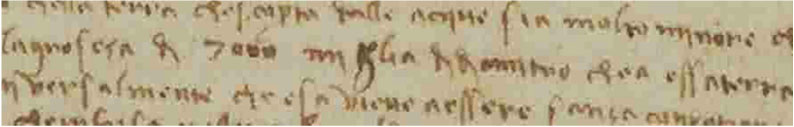
Leonardo′s handwriting made legible: (Codice Leicester, 35 verso & Codice Atlanticus 311 recto)
Source: www.leonardodigitale.com
The American Birth Certificate c. 1507 @ NYPL
It may be reproduced with the following text: "used with permission of the New York public library rare book division, Astor, Lenox and Tilden foundations.”
America: enlarged globular picture of the American birth certificate (NYPL). @ G. Zotti
Asia: enlarged globular picture of the American birth certificate (NYPL). @ G. Zotti
Europe and Africa: enlarged globular picture of the American birth certificate (NYPL). @ G. Zotti
For full text of this article, please visit
http://www.scirp.org/journal/PaperInformation.aspx?PaperID=57709.
If you have any questions, please feel free to contact ahs@scirp.org.