Prospects for Minimizing the Potential Environmental Impacts of the Hydro-Agricultural Dam of M’Bahiakro (Côte d’Ivoire) ()
1. Introduction
Agricultural sectors in Côte d’Ivoire, as in many developing countries, still have the center role in improving the rural economies. In order to achieve food self-sufficiency, Ivorian government is implementing a new program called National Rice Program (PNR) to increase rice production. The national production in rice of Côte d’Ivoire covers only about 50% of the needs of the Ivorian population [1]. The aim of the National Rice Program is to increase rice production by improving irrigation, drainage and management systems. Thus, this program plans to build several dams to support on-farm level irrigation development and management on dry season rice production in the main irrigated rice production areas. The reference [2] revealed that improving irrigation and drainage systems and management is particularly important to increase and stabilize agricultural production. However, the construction of dams over rivers disturbs their drainage regimes [3-7].
M’Bahiakro is a town in Côte d’Ivoire whose economy heavily depends on the agricultural sector. The National Rice Program is constructing a dam in M’Bahiakro over the N’Zi River in order to promote increased production of paddy rice to ensure food security and to generate revenues for the local population. The construction and the filling up of the hydro-agricultural dam of M’Bahiakro are expected to end in 2013. This dam is the first inflatable dam in Côte d’Ivoire and thus differs from previous existing dams. In its operation, it is to be submerged during high water periods. However, like the other reservoirs of Côte d’Ivoire, authorities didn’t plan any strategy to collect continuously data relating to hydrology and sedimentology in order to simulate the hydrodynamic and sedimentological functioning of the reservoir and the downstream river in the future. And yet, some research activities revealed that the fluctuations in the rainfalls and the flows over the watershed of the N’Zi River are very significant [8].
In Côte d’Ivoire, after the severe drought of the 1970s, more than 578 reservoirs had been constructed to improve water supply, electricity, agriculture and cattle [9]. But, most of those reservoirs (around 25% of them) no longer work properly because they are being filled with sediments. In fact, generally, agricultural activities, rapid and uncontrolled urbanization are increasing suspended sediment yield and affecting the morphology of surface waters [10]. The accelerated filling up of the reservoirs provokes floods, significant modifications of the physicochemical parameters and a fast development of aquatic plants [11]. So controlling suspended sediments by predicting their concentrations and their transport and fate in rivers and reservoirs is of vital importance to their management [12-14].
To better manage the hydro-agricultural dam of M’Bahiakro, it is necessary to have a database for modeling the hydrodynamic and sedimentological functioning of the reservoir as well as possible.
The aim of this paper is to characterize the physical environment and suggest solutions for a better management of the hydro-agricultural dam of M’Bahiakro.
2. Materials and Methods
2.1. Site
The study site is an irrigated area, located at about 6 km of M’Bahiakro city, on the catchment of the N’Zi River which is a tributary of the Bandama River (Figure 1).
The inflatable dam of M’Bahiakro is 5 m high and the altitude of the normal water level is 118 m. The reservoir of the dam will be established only in the bed of the N’Zi River over 30 km from the dam towards upstream, the surrounding land will not be submerged. At the normal water level the reservoir has a mean width of 70 m, an area of 180 ha and a capacity of 2.76 × 10⁶ m3. This dam is designed to irrigate a rice production area of 450 ha which extends over 9 km of length and a width varying between 300 and 1000 m. The relief of the N’Zi River catchment and particularly the irrigated area of M’Bahiakro is characterized by a flat topography. The catchment of the dam covers an area of 15,700 km2. The


Figure 1. Location of the hydro-agricultural dam of M’Bahiakro.
project flow (Q30) is 610 m3/s.
2.2. Methods
2.2.1. Data Collection
The hydrological data used in this study were obtained with the Water Resources Agency and the National Office of Rice Development of Côte d’Ivoire (hydrology, characteristics of the dam and the irrigated rice production area). The rainfall data cover the period from 1990 to 2004 and the N’Zi River flows from 1960 to 2004.
2.2.2. Field Observations and Sample Analyses
Field observations consisted in making in-situ measurements in the N’Zi River and collecting water samples for analysis. Samplings were made according to hydrological seasons. Thus, field observations were made in February 2012 (long dry season), June 2012 (long rainy season), August 2012 (short dry season) and October 2012 (short rainy season). Water samples were taken from three (03) monitoring stations. The physicochemical parameters (pH, temperature, electrical conductivity and Salinity) were measured in-situ using a multiparameter HANNA 9828 probe with 20 m cable. Samplings were made at the dam, upstream and downstream the dam (see Figure 1).
Water samples were also collected in plastic bottles for analysis at the laboratory. These bottles were washed and rinsed several times with deionized and sample water before sample collection. The samples were transported to the laboratory in ice chest and stored at 4˚C prior to analyses.
In the laboratory, nitrate, nitrite, ammonium, sulphate and phosphate were analyzed by spectrometry according to AFNOR standards NFT 90-013, NFT 90-012, NFT 90-015, NFT 90-040, NFT 90-023, using a JASCOV-530 molecular absorption spectrometer controlled by a computer. Sodium, calcium and magnesium concentrations were measured using atomic absorption spectrometry, according to AFNOR standards NFT 90-020, NFT90-003 and NFT 90-112 [15]. Suspended sediment concentrations were determined by filtering the samples through 0.45 μm millipore filters and then determining the ovendried weight of the filtered sediment.
2.2.3. Data Processing
The seasonal suspended sediment discharge in the reservoir of M’Bahiakro was calculated as follow [16,17]:
 (1)
(1)
where QSS is the seasonal suspended sediment discharges (kg/s or t), QL is the seasonal river flow (m3/s), C the seasonal suspended sediment concentration (g/L) and dt the time (the length of the season).
Finally, the annual suspended sediment discharge in the reservoir was obtained by adding the seasonal discharges.
In order to control the negative effects of irrigation water on soils and plants, the sodium adsorption ratio (SAR) was calculated by the following formula [18]:
 (2)
(2)
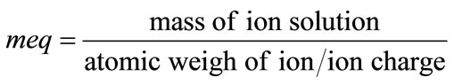
where meq represents a milliequivalent and is one thousand of a compound’s or an element’s equivalent weight. It is determined by:
 (3)
(3)
The SAR provides a classification of water cation chemistry as it pertains to its usefulness for irrigation [19,20]. The SAR was coupled with the conductivity to distinguish the different categories of water [18]. So waters were classified in terms of salinity hazard (conductivity) and sodium hazard (SAR).
3. Results
3.1. Rainfall and Hydrological Context for Irrigation
The annual variation of rainfall in the region of M’Bahiakro is illustrated in Figure 2. The rainfall is more important from April to June (120 - 150 mm) and from September to October (105 - 155 mm). In contrast, the rainfall is less important from November to March (0 - 50 mm) and from July to August (80 - 90 mm). These variations in the rainfall allow identifying four climate periods composed of two rainy seasons and two dry seasons. The annual average rainfall is 1000 mm with a standard deviation of 231 mm and a variation coefficient of 0.21.
The variations in flows of the N’Zi River at the hydrometric station of M’Bahiakro (Figure 3) indicate that the river is characterized by a high water level period from May to November and a low water level period

Figure 2. Seasonal average variation of the rainfall in M’Bahiakro from 1990 to 2004.

Figure 3. Seasonal average variations of the flows of the N’Zi River at the hydrometric station of M’Bahiakro from 1990 to 2004.
from November to April. The maximum flow of the N’Zi River is recorded during September-October with an average flow rate of 105 m3/s.
The flow submerged the site of the dam during high water level period from June to November (Figure 4). Water level rose up to the top of the constructing dam about 10 m in October 2012. The banks of the river on the site of the dam are sandy and high quantities of sand and detritus materials were dumped on the banks during the construction of the dam (Figure 4(a)).
The flows at the hydrometric station of M’Bahiakro as well as the rains are irregular. The flows have decreased till the 1970s and are still low compared to those of the 1960s (Figure 5). The seasonal variations showed that the gap between the low flows and the high flows is important. For example, maximum flows were 447 m3/s, 646 m3/s and 394 m3/s respectively in 1963, 1968 and 2003 while the minimum flow was about 0.01 m3/s. The gap between the low flows and the high flows is about 206 m3/s on average from 1990 to 2004. The annual average of the flow is 40 m3/s with a standard deviation of 32.52 m3/s and a variation coefficient of 0.88.
3.2. Physicochemical Characteristics of the N’Zi River for Irrigation
The physico-chemical parameters measured at the three sampling points in the N’Zi River around the hydro-agricultural dam of M’Bahiakro do not present significant difference along the river. Overall, the physicochemical characteristics of the N’Zi River fluctuate as follow (Table 1).
 (a)
(a) (b)
(b) (c)
(c)
Figure 4. Water level evolution on the site of the hydroagricultural dam of M’Bahiakro relating to the hydrological seasons. (a) long dry season (February 2012); (b) long rainy season (June 2012); (c) short rainy season (October 2012).

Table 1. Variations of the physicochemical parameters of the N’Zi River at the hydro-agricultural dam of M’Bahiakro.

Figure 5. Annual variations of the flows of the N’Zi River at the hydrometric station of M’Bahiakro from 1960 to 2004.
The N’Zi River has a mean pH close to neutral (pH = 7.37) with temperatures ranging between 24˚C and 30˚C. Suspended solids concentration (SSC) in the water range between 5 and 75 mg/L. Nutrients for plants: ,
,  ,
,  ,
,  have average concentrations of 0.004 mg/L, 4.3 mg L, 0.09 mg/L and 0.03 mg/L respectively.
According to the SAR average value (1.63) and the average conductivity (78.44 μS/cm) waters of the N’Zi River belong to class C1-S1 corresponding to the waters of high quality for irrigation.
3.3. Suspended Sediment Concentration at the Hydro-Agricultural Dam of M’Bahiakro
Table 2 presents the seasonal flows and suspended sediment concentration in the N’Zi River. Suspended sediment concentrations are higher during the rainy